
Exploring Pennsylvania: Mountains, Rivers, Historic Towns, Waterfalls, and Scenic Roads
Some states are remembered for a single landscape.
Mountains. Coastline. Desert.
Pennsylvania is remembered for its transitions.
A road trip across the Commonwealth can begin where a nation was founded, continue through working farmland, climb forested Appalachian ridges, descend into river valleys, pass waterfalls and quiet small towns, and end beside the open water of Lake Erie. Few states change so completely without ever asking you to cross a border.
That variety is what makes Pennsylvania such a rewarding state to explore by road. Its most memorable places are not gathered into one tourism corridor or concentrated around a single national park. They are spread across the Commonwealth, connected by highways, historic routes, forest roads, and country lanes that repeatedly change the character of the trip.
Pennsylvania is not a state that reveals itself all at once. It unfolds through a collection of remarkably different journeys connected by the roads between them.

Pennsylvania Reveals Itself in Transitions
Many travel guides divide Pennsylvania into categories: parks, cities, museums, historic sites, and scenic drives. That may help organize a map, but it misses what makes traveling here so interesting. Pennsylvania is best understood through its transitions.
A morning can begin among the waterfalls of Ricketts Glen and end beneath the stars near Cherry Springs. A drive through Lancaster County can move from working farms and roadside markets to the streets where the nation's earliest political ideas took shape. In western Pennsylvania, mountain streams descend toward river towns that later became centers of iron, steel, rail transportation, and industry.
Even the roads tell several different stories. Interstate highways cross the state efficiently, but older routes reveal the geography that shaped Pennsylvania long before modern travel. They follow rivers, climb ridges, pass through gaps, and enter towns whose main streets once served as essential links between eastern ports and the interior of the country.
To appreciate Pennsylvania, it helps to resist the temptation to treat those places as unrelated stops. The landscape, history, and communities are connected. Rivers explain the cities. Mountains explain the roads. Roads explain the towns. The towns, in turn, reveal how geography became history.
Scenic Roads That Turn Distance into Experience
Pennsylvania has an extensive system of designated byways, but scenic driving is not limited to officially named routes. Roads throughout the state follow rivers, cross ridges, enter forests, and connect towns that developed long before travel became primarily about speed.
Route 6 across the northern tier is one of the state's defining road trips. It links historic communities, forests, overlooks, the Pennsylvania Wilds, and attractions spread across hundreds of miles. Rather than offering one continuous type of scenery, the route reveals how often northern Pennsylvania changes.
The Laurel Highlands Scenic Byway combines waterfalls, forest, farmland, architecture, and small towns. The Brandywine Valley Scenic Byway carries travelers through a landscape shaped by history, art, agriculture, and the communities outside Philadelphia.
Other drives become memorable because of what they follow: the Delaware River, the Susquehanna, the Allegheny, or roads winding through the state's mountain gaps and forestlands.
The most satisfying route may not always be the fastest. A slower road gives geography time to become visible. It shows where farms occupy valleys, where towns gather beside water, where industry required access to rail and rivers, and where mountains still determine the direction of travel.
Philadelphia and the Delaware: Where a National Story Begins
For many travelers, Pennsylvania begins with Philadelphia. The city is inseparable from the founding of the United States, yet its historic importance is easy to reduce to a few familiar names: Independence Hall, the Liberty Bell, and the Declaration of Independence.
Those landmarks matter, but the experience becomes richer when they are understood as part of a living city rather than isolated monuments. The streets of Old City, the Delaware River waterfront, colonial-era buildings, churchyards, rowhouses, markets, museums, and neighborhoods reveal layers of history that continued long after the nation's founding documents were signed.
Independence National Historical Park preserves the places where the Declaration of Independence and the United States Constitution were debated and signed. Walking through the surrounding blocks makes it possible to see how closely political history, commerce, religion, and daily life once occupied the same small area.
Philadelphia also introduces one of Pennsylvania's recurring themes: rivers are never simply scenery. The Delaware helped connect the city to regional and international trade. It shaped settlement, transportation, defense, and industry. Farther north, the same river passes smaller communities, wooded hills, and historic crossings, offering an entirely different experience from the urban waterfront.
A Pennsylvania road trip can therefore begin with history while already pointing toward the landscape. Follow the river, and the city gradually gives way to another version of the state.
Pennsylvania's national story may begin in Philadelphia, but it does not stay there. The farther west and north the road leads, the more completely the state reinvents itself.
Brandywine Valley and the Countryside Beyond Philadelphia
West and south of Philadelphia, the Brandywine Valley offers a gentler transition from city to countryside. Roads pass through wooded hills, historic communities, farms, gardens, and landscapes associated with both American history and art.
The region includes portions of the Brandywine Valley Scenic Byway, where the road itself becomes part of the experience. Chadds Ford, Kennett Square, West Chester, and the surrounding countryside provide opportunities to combine galleries, historic sites, gardens, local food, and scenic driving without covering great distances.
This part of Pennsylvania demonstrates how quickly the state can change. The skyline of Philadelphia may be less than a day behind you, yet the journey has already shifted toward stone buildings, narrow roads, old trees, and communities whose stories are tied to agriculture and the land.
It is the first reminder that Pennsylvania rarely requires a dramatic border crossing to feel different. Sometimes the transformation happens one road at a time.
Northeastern Pennsylvania continues that progression. Promised Land State Park, surrounded by the Delaware State Forest, and nearby Gouldsboro State Park demonstrate another side of the Commonwealth, where quiet lakes, wooded campgrounds, wetlands, and higher-elevation forests create an entirely different rhythm from the countryside surrounding Philadelphia.
Lancaster County: A Landscape Still Shaped by Work
Lancaster County is often described through its Amish communities, covered bridges, farm stands, and horse-drawn buggies. Those are visible parts of the region, but the deeper story is the relationship between land, tradition, and work.
The countryside is not a themed backdrop. It is productive land divided by fields, farm lanes, barns, workshops, homes, markets, and small towns. Traveling through the area becomes more meaningful when visitors remember that the landscape exists first as a place where people live and work.
Roadside stands, bakeries, local markets, handcrafted goods, and seasonal produce create natural reasons to stop. Towns such as Lititz, Strasburg, and Ephrata add architecture, local history, cafés, and walkable streets to the wider rural experience.
The best drives here are rarely about reaching one major attraction. They are about allowing time for the road to reveal details: laundry moving in the wind, teams working in a field, a covered bridge spanning a creek, or a farm market that was never part of the day's plan.
Lancaster County teaches a useful lesson about Pennsylvania travel. Slowing down is not an interruption to the trip. It is often how the trip becomes memorable.
Gettysburg: A Landscape That Requires Time
Gettysburg National Military Park is one of the most consequential historic landscapes in the United States. Yet the battlefield can be difficult to understand when approached as a quick collection of monuments.
The scale matters. Roads cross open fields, ridges, farms, stone walls, wooded ground, and positions that only begin to make sense as they are seen in relation to one another. Seminary Ridge, Cemetery Ridge, Little Round Top, the Peach Orchard, Culp's Hill, and the fields associated with Pickett's Charge are parts of a much larger story unfolding across the terrain.
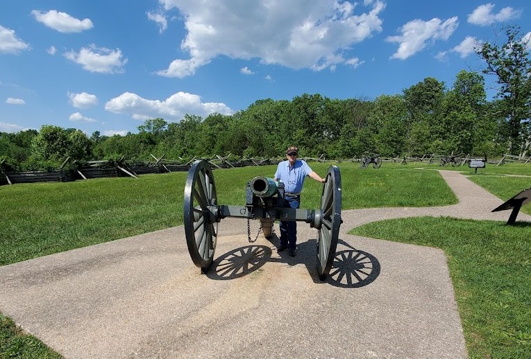
A worthwhile visit leaves room for the museum and visitor center, but also for driving or walking portions of the battlefield without rushing. The land itself becomes a historical document. Distances, elevations, visibility, and obstacles help explain decisions that can feel abstract when encountered only in a book.
The town of Gettysburg adds another layer. Historic buildings, museums, restaurants, and streets filled with visitors sit beside a landscape associated with enormous loss. Moving between the town and the battlefield creates a tension that is part of the experience: ordinary life continuing beside a place permanently marked by history.
Gettysburg is not simply somewhere to learn what happened. It is a place to consider how geography, human decisions, and national memory become inseparable.
The Appalachian Ridges and the Roads Between Them
Central Pennsylvania is crossed by long Appalachian ridges that shape nearly every road traveling through the region. From above, the mountains appear as parallel folds extending across the state. From the driver's seat, they are experienced as climbs, gaps, overlooks, forested slopes, and valleys where farms and communities developed between higher ground.
These ridges explain why many historic routes follow particular corridors. Roads often use river valleys or mountain gaps because the terrain leaves few easier choices. Towns grew where travelers, railroads, canals, and later highways could move through the landscape.
The mountains influenced far more than scenery. They directed canals toward navigable water, forced railroads to search for workable grades, shaped the earliest turnpikes, and determined which communities became important stopping points. Commerce followed the routes the land allowed, leaving a pattern that remains visible in Pennsylvania's roads and towns today.
The result is a part of Pennsylvania where driving becomes unusually instructive. A road may climb through hardwood forest, descend toward a river, follow a narrow valley past small communities, and then rise again to an overlook. The scenery is not separate from the state's human history. It influenced where people settled, how goods moved, and which towns became important.
This is also where Pennsylvania begins to feel larger than its location on the map suggests. The ridges interrupt straight lines. They make the journey more physical, giving travelers a sense of crossing rather than merely passing through.
Places such as Worlds End State Park capture that feeling particularly well. Deep valleys, wooded ridges, and Loyalsock Creek remind visitors that Pennsylvania's mountains are not simply scenery beside the highway—they are landscapes meant to be experienced from within.
Ricketts Glen: Following Water Through the Forest
Water has been quietly shaping Pennsylvania for millions of years, and few places make that story easier to follow than Ricketts Glen State Park. The park is known for its series of named waterfalls, but the experience is greater than the number alone suggests. The Falls Trail moves through a landscape where water repeatedly changes elevation, direction, sound, and speed.

The trail passes cascades framed by rock, ferns, hemlocks, and hardwood forest. Some waterfalls announce themselves through sound before they become visible. Others appear around a turn, changing the scale and mood of the gorge within only a few steps.
This is not a trail that should be treated as a race between viewpoints. Wet rock, steep sections, roots, and changing conditions require attention. That slower pace becomes an advantage. It allows the forest and water to be experienced as one continuous environment rather than a succession of photographs.
Camping nearby can change the visit entirely. An early start offers cooler temperatures, softer light, and a quieter trail. Returning to a campsite afterward allows the experience to continue without immediately turning toward the next distant destination.
Ricketts Glen demonstrates why Pennsylvania's waterfalls feel different from isolated roadside attractions. They belong to larger systems of forest, elevation, weather, and moving water. The trail does not merely take you to them. It allows you to follow the landscape that created them.
Pine Creek Gorge: Pennsylvania on a Larger Scale
Pine Creek Gorge is often called the Grand Canyon of Pennsylvania. The comparison helps communicate its scale, but the gorge has a character entirely its own.
Forested slopes descend toward Pine Creek, forming a long corridor through north-central Pennsylvania. Overlooks at Leonard Harrison and Colton Point state parks provide broad views across the canyon, while the Pine Creek Rail Trail offers a very different experience near the water below.
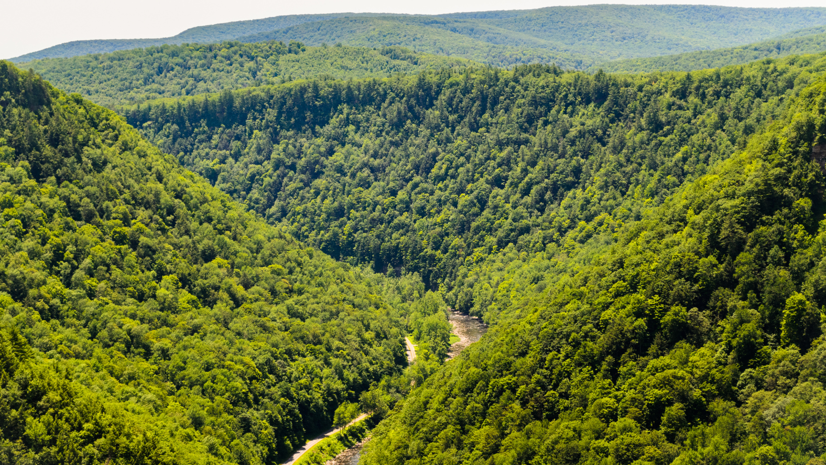
From above, the gorge reveals the scale of Pennsylvania's forested interior. In autumn, the slopes become a wide field of changing color. In spring and summer, layers of green emphasize the depth and length of the valley. Winter strips the landscape to its structure, exposing ridges and contours hidden during the growing season.
At trail level, the experience becomes more intimate. Cyclists and walkers follow the former railroad corridor beside Pine Creek, passing rock walls, forest, bridges, small communities, and access points that make shorter outings possible.
The difference between the overlooks and the rail trail is part of what makes the region worth more than a brief stop. One reveals the whole landscape. The other allows you to enter it.
Pine Creek Gorge also captures something essential about Pennsylvania: some of the state's most dramatic scenery remains hidden until the road suddenly opens and reveals a landscape far larger than expected.
Cherry Springs: When Darkness Becomes the Destination
Most travel days are organized around what can be seen in daylight. Cherry Springs State Park reverses that expectation.
Located amid the forests of north-central Pennsylvania, the park is known for its exceptionally dark night skies. On clear nights, stars become visible in numbers that many visitors have never experienced near cities or developed areas. The Milky Way can stretch across the sky, while planets, satellites, constellations, and occasional meteors turn darkness into the main event.

A successful visit requires more planning than simply arriving after sunset. Weather, cloud cover, moonlight, seasonal temperatures, and park guidelines all affect the experience. Reducing artificial light and allowing time for eyes to adjust helps reveal what darkness has been hiding.
Cherry Springs feels surprising because it is located in the eastern United States, within driving distance of major population centers. Its skies offer evidence that remoteness is not always measured by distance alone. Sometimes it is measured by how completely the modern world disappears after the sun goes down.
The Pennsylvania Wilds: Forests, Elk, and Long Horizons
The Pennsylvania Wilds is the name given to a broad north-central region defined by extensive public lands, large forests, small communities, rivers, wildlife, and some of Pennsylvania's least developed landscapes. The name describes more than remoteness. It reflects a region where the spaces between destinations are part of the experience.
Near Benezette and the surrounding Elk Country, visitors may hear bugling during the fall rut or see elk moving through fields and forest edges. The animals are wild, and sightings are never guaranteed, which is precisely why patience and responsible observation matter.
The region also includes scenic roads, overlooks, hiking trails, waterways, historic communities, and remnants of industries that once depended on timber, mining, and transportation. It is a place where natural recovery and human history often occupy the same view.
Traveling through the Pennsylvania Wilds can feel less like moving between attractions and more like entering a broad landscape. Distances between services may be greater, cell coverage can be less dependable, and weather can change how quickly a day unfolds. Those practical considerations are part of the region's appeal rather than inconveniences to be erased.
The Wilds reward travelers who arrive prepared but remain flexible. A wildlife sighting, an unplanned overlook, or a quiet road through autumn forest may become more memorable than the destination originally entered into the navigation system.
Allegheny National Forest and the Reservoir Country
In northwestern Pennsylvania, Allegheny National Forest protects more than half a million acres of forest, streams, trails, recreation areas, and reservoir shoreline. It is the state's only national forest and one of the largest public landscapes in Pennsylvania.

The Allegheny Reservoir introduces broad water views and access for boating, fishing, paddling, and camping. Forest roads lead toward trailheads, overlooks, picnic areas, and quieter corners where the scale of the surrounding woods becomes more apparent.
This is a landscape with a complicated history. Much of the region was heavily logged before the national forest was established. The forest seen today is therefore not untouched wilderness, but a landscape shaped by extraction, recovery, management, and time.
That history adds depth to a visit. The trees provide shade, wildlife habitat, recreation, and beauty, but they also tell a story about how land can change across generations.
A few days here can easily combine hiking, water, scenic driving, and unstructured time at camp. The forest does not need to deliver one defining attraction. Its value comes from having enough room for travelers to choose their own pace.
Northwestern Pennsylvania: Lakes, Wetlands, and Places Between Destinations
Northwestern Pennsylvania is sometimes treated as the space between Pittsburgh, the national forest, and Lake Erie. That overlooks a region filled with lakes, wetlands, wildlife areas, old towns, and waterways that have shaped settlement for centuries.
In places, this corner of the Commonwealth feels as connected to the Great Lakes as it does to the Appalachian interior. Water, glacial landscapes, lake-effect weather, migration routes, and communities oriented toward Erie and nearby states give the region a character distinct from central or eastern Pennsylvania.
Pymatuning State Park surrounds a vast reservoir extending across the Pennsylvania-Ohio border. Its shorelines, wetlands, campgrounds, boating access, and birdlife make it a destination large enough to support several different kinds of trips.
Farther east, Meadville sits along French Creek near Woodcock Lake, the Erie National Wildlife Refuge, Conneaut Lake, and a network of country roads through Crawford County. The region becomes more understandable when followed through its water: creeks leading to rivers, wetlands supporting migration, and lakes shaping both recreation and community life.
These are places where a trip often expands after arrival. A planned night near a lake may lead to a historic market house, a wildlife refuge, a paddling route, or a town that had previously been little more than a name on a road sign.
Northwestern Pennsylvania reminds travelers that the spaces between major destinations are not empty. They are often where a state reveals its most personal stories.
Lake Erie and Presque Isle: Pennsylvania Reaches Open Water
Pennsylvania has only a relatively short Lake Erie shoreline, yet the experience is unlike anything else in the state.
Presque Isle State Park curves into the lake near Erie, creating beaches, bays, trails, wetlands, and important habitat for migrating birds. The peninsula offers opportunities to swim, paddle, cycle, walk, fish, watch wildlife, or simply look across water broad enough to resemble an inland sea.
The change is striking after traveling through mountains and forests. The horizon opens. Weather moves across the lake. Sunsets stretch across unobstructed water. The geography feels almost coastal even though the ocean is hundreds of miles away.
Erie's maritime and industrial history adds context to the landscape, while the city provides museums, restaurants, supplies, and a useful base for exploring the shoreline.
Lake Erie completes one of Pennsylvania's most remarkable transitions. A traveler can begin beside tidal waters in Philadelphia, cross mountains and river valleys, and eventually reach freshwater that disappears beyond the horizon—all without leaving the state.
Pittsburgh: A City Explained by Three Rivers
Pittsburgh is often introduced through its industrial past, but the city's geography explains why that history developed here.
The Allegheny and Monongahela rivers meet to form the Ohio River at the Point. Hills rise sharply around the waterways, bridges connect neighborhoods across difficult terrain, and overlooks reveal a city built in conversation with its rivers.
The meeting of water, transportation, coal, iron, immigration, and industry helped transform Pittsburgh into a major center of American production. That legacy remains visible in architecture, former industrial sites, museums, neighborhoods, rail lines, and the language of the city.
Yet Pittsburgh is not frozen in that era. Riverfront trails, universities, medical centers, restaurants, arts institutions, sports, and neighborhoods with distinct identities make it a city that continues to reinterpret its past.
Places such as the Carnegie museums and the Andy Warhol Museum offer very different ways into the city's cultural history. Inclines climbing Mount Washington provide both transportation heritage and some of the clearest views of how completely rivers and hills define Pittsburgh's form.
Seen from above, the city stops looking like a collection of attractions. It becomes a lesson in why certain places grow where they do.
That relationship between city and landscape continues beyond Pittsburgh itself. Raccoon Creek State Park, less than an hour away, offers forests, wetlands, trails, and lakes that illustrate just how quickly western Pennsylvania can transition from an urban skyline to peaceful outdoor recreation.
Ohiopyle and the Laurel Highlands: Water in Motion
Southeast of Pittsburgh, the Laurel Highlands introduce another version of western Pennsylvania. Forested ridges, rushing rivers, waterfalls, trails, farms, historic roads, and architectural landmarks create one of the state's most concentrated road-trip regions.
Ohiopyle State Park centers on the Youghiogheny River, where whitewater draws rafters and kayakers while trails and overlooks provide ways to experience the landscape from shore. The Great Allegheny Passage passes through the community, connecting cyclists and walkers to a much longer route between Pittsburgh and the Washington, D.C., area.
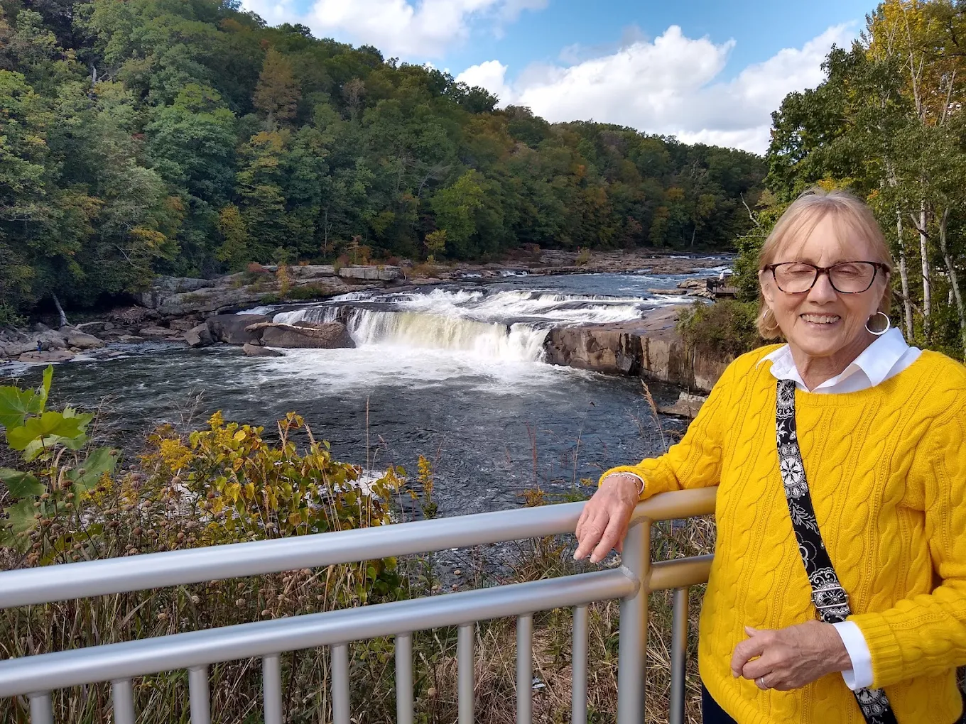
Water is the force that gives Ohiopyle its energy. The river cuts through the landscape, waterfalls interrupt tributaries, and changing flow conditions alter both the sound and appearance of the park.
The surrounding Laurel Highlands Scenic Byway follows Routes 711 and 381 through rolling countryside, wooded hills, small towns, recreational areas, and places associated with Frank Lloyd Wright. Fallingwater is the best known, but its importance comes partly from how completely the house responds to the stream, rock, forest, and waterfall around it.
This region makes it possible to move between outdoor adventure, architecture, history, and rural scenery without breaking the continuity of the trip. The road does not simply connect the attractions. It explains why they belong together.
Small Towns Are Not Gaps in the Itinerary
Pennsylvania's cities and famous parks naturally receive attention, but many of the state's most revealing moments occur in smaller communities.
Old courthouse squares, railroad depots, brick storefronts, diners, bakeries, breweries, local museums, river walks, and farmers markets often preserve stories that broader travel guides overlook. Some towns grew around canals. Others served mining regions, railroads, farms, forests, steel mills, or river crossings.
Their fortunes changed as transportation and industry changed. A road that once brought constant traffic may now bypass the center of town. A former industrial building may hold apartments, studios, or a local business. A market house may continue serving the same community in a way that feels both historic and entirely current.
Stopping in these places does more than add variety to a road trip. It helps connect Pennsylvania's landscapes with the people who lived and worked within them.
A waterfall may explain geology. A battlefield may explain national history. A small town often explains how those larger forces became everyday life.
Hershey and the Stories Found Outside the Expected Categories
Not every Pennsylvania stop fits neatly into a story about wilderness or national history.
Hershey offers a lighter chapter, built around the history of chocolate, manufacturing, entertainment, and the community associated with Milton Hershey's ambitions. Hershey's Chocolate World, Hersheypark, museums, gardens, and nearby attractions make the area especially popular with families.
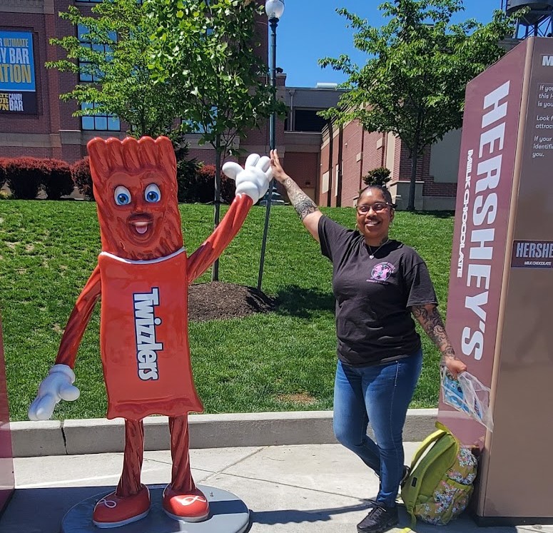
What makes Hershey relevant to a broader Pennsylvania journey is not merely the product that made the town famous. It is another example of how industry, community planning, philanthropy, transportation, and tourism can shape a place.
Pennsylvania contains many such stories: coal towns, railroad communities, steel cities, canal villages, resort towns, and agricultural centers. Each grew from a different relationship between people, resources, geography, and opportunity.
The state becomes more interesting when those places are not treated as interruptions between natural landmarks. They are part of the same story.
Camping Changes How Pennsylvania Is Experienced
Pennsylvania's state parks, national forest recreation areas, private campgrounds, and other public lands make it possible to remain close to many of the landscapes described in this guide.
Camping near a destination changes more than the night's accommodations. It changes the hours available for experiencing a place. A campground often becomes tomorrow morning's trailhead.
A campsite near Ricketts Glen can make an early walk on the Falls Trail practical. Staying in the Pennsylvania Wilds creates time to listen for elk near dawn or remain outside after sunset. Camping near Cherry Springs removes the pressure to drive a long distance after a night of stargazing. A site near Ohiopyle or the Allegheny Reservoir allows water, weather, and forest to remain part of the experience after the day's primary activity ends.
Campgrounds vary widely in season, services, reservation requirements, setting, and vehicle accommodations. Checking current information before arrival remains important, especially during peak foliage, summer weekends, holidays, and special events.
The practical details matter, but they serve a larger purpose. Staying nearby allows a destination to be experienced during its quieter hours, when the parking lots empty, the light changes, and the landscape begins to feel less like somewhere visited and more like somewhere temporarily lived.

When to Explore Pennsylvania
There is no single best season for a Pennsylvania road trip because every season changes the state in a different way.
Spring brings waterfalls, flowing streams, wildflowers, cool hiking conditions, and fresh green across the forests. Trails can also be wet or muddy, and mountain weather may remain unpredictable.
Summer opens the widest range of camping, paddling, cycling, swimming, festivals, and long evenings outdoors. Popular parks and destinations can become busy, making weekday visits or early starts especially valuable.
Autumn is one of Pennsylvania's most visually dramatic seasons. Color moves through the state according to elevation, latitude, weather, and forest composition. The same road can look entirely different within a few weeks. Campgrounds, overlooks, and scenic routes may also be at their busiest.
Winter reveals the structure beneath the landscape. Bare trees open views across valleys and historic sites, while snow can transform forests and small towns. Some facilities and roads operate seasonally, so planning becomes more important.
Rather than choosing a season only for ideal conditions, it can be more rewarding to ask what version of Pennsylvania you hope to see.
One State, Many Journeys
Pennsylvania cannot be understood through a single destination.
Philadelphia explains the nation's founding, but not the dark skies above Cherry Springs. Gettysburg explains a pivotal battle, but not the forest recovery visible in the Allegheny National Forest. Lancaster County reveals a working agricultural landscape, while Pittsburgh demonstrates how rivers, industry, immigration, and geography built a major city. Pine Creek Gorge, Presque Isle, Ohiopyle, Ricketts Glen, and the small towns between them each add something the others cannot provide.
That is why a Pennsylvania road trip can feel like several journeys sharing the same map.
The state keeps changing, but it never becomes disconnected. Rivers lead toward cities. Mountains shape roads. Farms occupy valleys. Industrial history follows natural resources. Towns appear where travel and work once required them to be.
The reward comes from recognizing those relationships.
Pennsylvania rewards travelers who keep going just a little farther. Around the next bend may be another waterfall, another river valley, another historic town, another overlook, or another story that was never part of the itinerary when the day began.
That may be the state's greatest strength. It rarely asks travelers to choose between history, scenery, recreation, or small-town character because, more often than not, the road quietly connects them all.
Pennsylvania is not simply a place with parks, history, waterfalls, and scenic roads. It is a state where each helps explain the others.
A Campervan That Leaves Room for the Journey
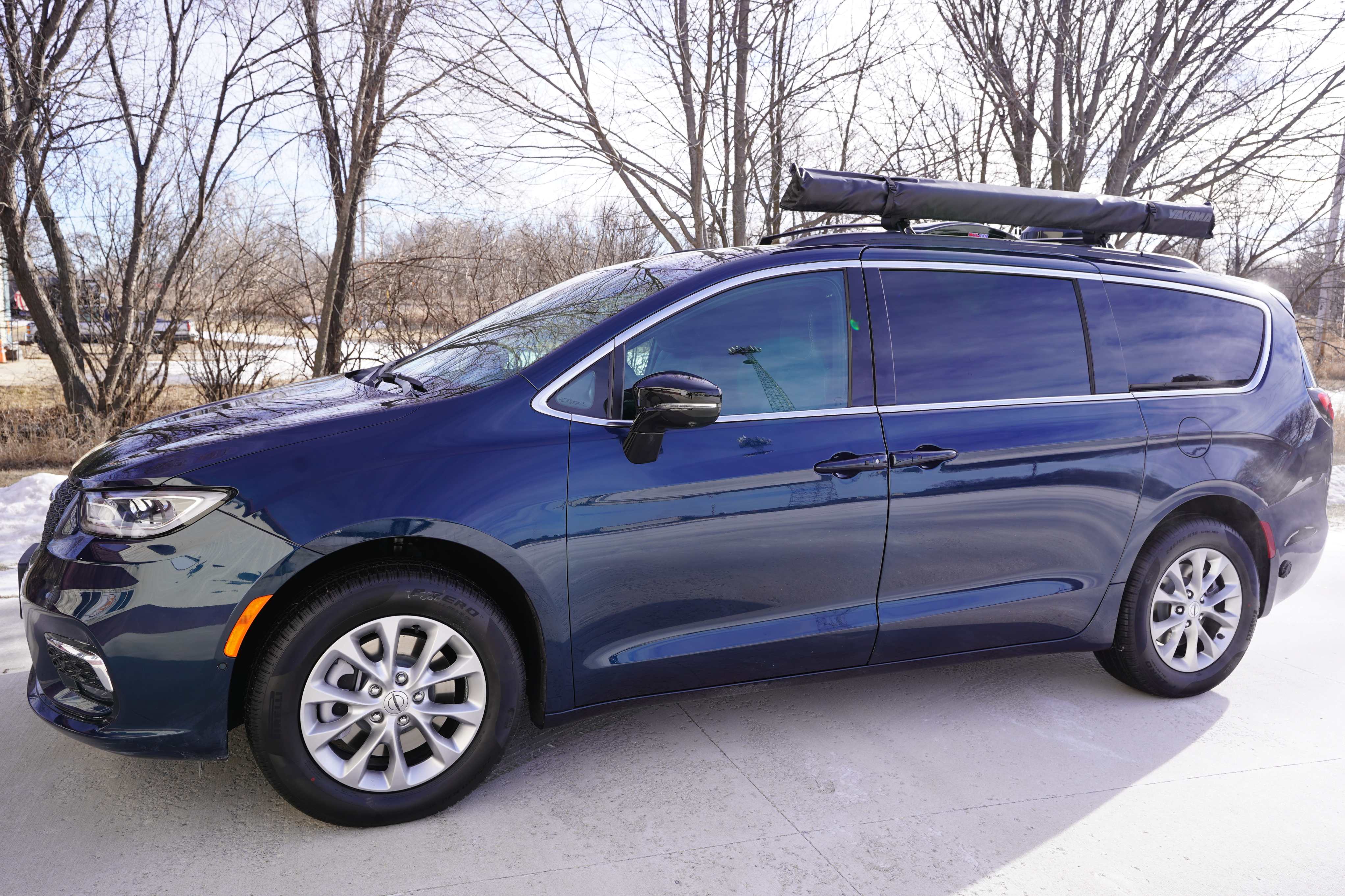
The Mini-T Campervan is well suited to a state where the experience changes so often. Its compact size makes it practical for historic streets, scenic roads, trailhead parking, lakeside campgrounds, and the ordinary stops that become part of a longer trip.
That versatility matters in Pennsylvania because the best journey may include several very different days. One may be spent walking through Philadelphia. Another may begin on a waterfall trail, continue through a small town, and end beneath a dark sky. The vehicle does not need to become the focus of those experiences. It simply needs to make moving between them comfortable and uncomplicated.
The purpose of the trip is not to think about the campervan.
It is to remember how many different versions of Pennsylvania were waiting along the same road.

DLM-Distribution / Campervans is a licensed manufacturer and dealer located in Lake Crystal, Minnesota, serving clients around the country.
Contact Dave: 651-285-7089 or Candy: 507-382-9446 today!