Long Beach, Washington: Exploring the Wild Beauty of the Long Beach Peninsula
Washington's Long Beach Peninsula feels different from much of the Pacific Northwest. It is narrower, quieter, and more exposed to the moods of the ocean. The Pacific stretches along one side, Willapa Bay rests on the other, and between them lies a long ribbon of beaches, dunes, coastal forest, working harbors, historic communities, wildlife habitat, and roads that invite travelers to slow down.
Long Beach sits near the southern end of the peninsula and provides a natural basecamp for exploring the region. From town, travelers can walk or bike beside the dunes, visit two historic lighthouses, follow the final coastal chapters of the Lewis and Clark Expedition, explore the fishing port of Ilwaco, drive north toward Oysterville and Leadbetter Point, or simply spend an afternoon watching the Pacific change with the weather.
This is not a coast defined only by sunshine. Fog, wind, rain, shifting clouds, and winter storms are part of the landscape. Those conditions do not diminish the experience. They give the peninsula its character. A lighthouse appearing through mist, waves breaking beneath a dark sky, or sunlight suddenly opening across the beach can become more memorable than a perfectly clear day.

Long Beach Is the Beginning, Not the Whole Destination
The town of Long Beach offers restaurants, shops, galleries, museums, lodging, and easy access to the ocean, but the larger experience extends across the entire peninsula. The Long Beach Peninsula separates the open Pacific from the calmer waters of Willapa Bay, creating two distinctly different coastlines within a short drive of one another.
On the west side, broad beaches face the ocean and carry the full force of Pacific weather. On the east side, tidal flats, oyster beds, marshes, and sheltered coves shape life along Willapa Bay. The contrast is one of the peninsula's greatest pleasures. A morning can begin with waves and wind on the ocean, then end with still water, shorebirds, and evening light across the bay.
The peninsula is best explored as a collection of connected places rather than a checklist. Long Beach, Ilwaco, Cape Disappointment, Seaview, Ocean Park, Oysterville, Leadbetter Point, and Willapa Bay each reveal a different part of the coast.
Walking the Pacific Shore
The beach is the peninsula's most immediate attraction. It extends for miles, wide enough in many places to create a feeling of enormous open space between the dunes and the ocean. At low tide, the wet sand reflects the sky. Driftwood gathers near the upper beach, shorebirds work the waterline, and the horizon can seem almost impossibly far away.
Some travelers come to walk, fly kites, search for shells, photograph sunsets, or simply listen to the surf. Others visit during razor clam seasons, when approved digs and favorable tides bring families and longtime clammers to the shore. Conditions, licenses, seasons, and openings can change, so anyone planning to harvest shellfish should confirm current Washington Department of Fish and Wildlife regulations before arriving.
Vehicle access is permitted on some Washington beaches, but the shore is legally treated as a roadway where posted rules apply. Open areas, seasonal closures, speed limits, tides, soft sand, pedestrians, wildlife, and changing beach conditions all require careful attention. Travelers who do not need to drive on the beach may find that walking from an established access point offers a more relaxed way to experience the coast.
The ocean here deserves respect. Cold water, strong currents, sneaker waves, drifting logs, and rapidly changing tides are genuine hazards. The safest visits are the ones that leave plenty of distance between people and breaking surf, especially during storms or high-wave events.
The Discovery Trail: A Journey Along the Dunes
One of the best ways to explore the southern peninsula without a car is the Discovery Trail. The approximately 8.5-mile paved and gravel route connects Ilwaco with the Long Beach area, passing through coastal forest, around the Cape Disappointment headlands, beside Beard's Hollow, and north through the dunes.
The trail was created as a Lewis and Clark commemorative route, and interpretive panels and public art appear along the way. Yet its appeal goes well beyond history. Walkers, runners, cyclists, and skaters move through a changing coastal landscape where the sound of the Pacific is often present even when the water is hidden behind the dunes.
There is no need to complete the entire trail. Multiple access points make shorter outings easy. A morning ride from Long Beach, an evening walk near the dunes, or a longer trip toward Ilwaco can each provide a different perspective on the peninsula.
The trail is especially enjoyable when the weather changes. Fog can soften the landscape, wind can move through the beach grass, and late-day light can turn the dunes gold. It is one of those places where the journey itself matters more than reaching a particular endpoint.
Cape Disappointment State Park
At the southern end of the peninsula, Cape Disappointment State Park brings together nearly everything that defines this coast: forested headlands, freshwater lakes, marshes, ocean beaches, historic military sites, two lighthouses, and sweeping views over the Columbia River entrance.
The park's name sounds discouraging, but the landscape is anything but. British trader John Meares applied the name in 1788 after mistakenly concluding that the broad water before him was only a bay rather than the mouth of the Columbia River. By the time Lewis and Clark reached the Pacific in 1805, the name had already become part of the map.
Today, trails move through dense coastal forest and emerge at viewpoints above the water. Waikiki Beach sits in a protected cove near the North Jetty, while Benson Beach opens toward the Pacific. Freshwater lakes and wetlands add quieter habitat inland from the surf.
The park is large enough to deserve more than a quick stop. A traveler could spend the morning hiking to a lighthouse, visit the interpretive center after lunch, walk the beach late in the afternoon, and still leave parts of the park for another day.
North Head Lighthouse
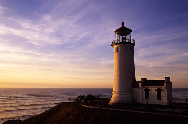
North Head Lighthouse stands on a high bluff overlooking the Pacific. The walk from the parking area is relatively short, but the setting makes it feel significant. The trail passes through wind-shaped coastal vegetation before opening to broad ocean views.
The lighthouse began service in the late nineteenth century to improve navigation along a coast known for fog, storms, shifting sandbars, and dangerous conditions near the mouth of the Columbia River. Its white tower and red roof remain among the peninsula's most recognizable sights.
Tours are seasonal, and parking near the lighthouse is limited. Washington State Parks notes that the North Head Lighthouse parking area does not accommodate RVs, making a compact vehicle especially useful. Even when the tower is closed, the walk and surrounding viewpoints remain worthwhile.
North Head is particularly memorable when clouds move quickly across the water. Sunlight may illuminate one section of the ocean while rain falls farther offshore. The lighthouse appears less like a static landmark and more like part of a working coastal landscape.
Cape Disappointment Lighthouse and the Columbia River Bar
Cape Disappointment Lighthouse stands above the meeting place of the Columbia River and the Pacific Ocean. Reaching the viewpoint requires a forested hike with elevation change, but the destination reveals one of the most consequential maritime passages on the West Coast.
The Columbia River Bar has long challenged ships with strong currents, changing shoals, powerful waves, and the interaction between river flow and ocean swell. From the headlands, travelers can sometimes watch commercial vessels approach or leave the river while fishing boats, pilot vessels, and the U.S. Coast Guard operate below.
The view helps explain why the region developed such a strong lighthouse, military, lifesaving, and maritime tradition. The landscape is beautiful, but it has never been gentle.
The Lewis and Clark Interpretive Center
Within Cape Disappointment State Park, the Lewis and Clark Interpretive Center sits on cliffs roughly 200 feet above the surf. Exhibits follow the Corps of Discovery across the continent and give particular attention to the expedition's arrival at the Pacific during the winter of 1805–1806.
The center helps connect the familiar names of Lewis and Clark to the actual landscape around the visitor. The headlands, river mouth, beaches, rain, wind, and winter weather were not background scenery. They shaped the expedition's decisions and daily experience.
It is equally important to remember that Indigenous communities had lived, traveled, traded, harvested, and navigated throughout this region for countless generations before the expedition arrived. A thoughtful visit should place the Lewis and Clark story within that much longer human history.
Ilwaco and the Working Waterfront
Just east of Cape Disappointment, Ilwaco provides a different kind of coastal experience. The Port of Ilwaco is a working harbor where fishing boats, charter vessels, seafood businesses, galleries, and public spaces share the waterfront.
A walk along the harbor can reveal the practical rhythms of coastal life: boats being prepared, crab pots stacked on docks, crews returning from the water, and weather reports shaping the day's plans. The waterfront also hosts shops, dining, art, and seasonal events, but it has not lost its connection to fishing and maritime work.
Ilwaco is a good place to slow down after hiking at the cape. Lunch near the harbor, a walk among the boats, and an unhurried drive through town provide a quieter transition between the dramatic headlands and the open beaches farther north.
Fort Columbia and the Columbia River
East of Ilwaco, Fort Columbia Historical State Park occupies a hillside above the Columbia River. The former coastal defense installation is considered one of the most intact historic forts of its kind in the United States.
Visitors can walk among preserved batteries, barracks, officers' quarters, and other structures while looking across the broad river toward Oregon. The fort was part of a network created to defend the Columbia River entrance, and its location makes that purpose immediately understandable.
Fort Columbia is primarily a day-use destination, but its historic buildings and river views make it an excellent addition to a peninsula itinerary. It also provides a different perspective on the same waterway seen from Cape Disappointment—less exposed to the Pacific, but still immense and central to the region's story.
Crossing the Astoria-Megler Bridge
The Astoria-Megler Bridge connects Washington's peninsula with Astoria, Oregon, across the mouth of the Columbia River. The crossing is approximately four miles long and offers a memorable transition between two coastal regions.
From the bridge, travelers gain a broader sense of the river's scale, the working shipping channel, and the low landscapes surrounding its mouth. Weather can change the experience dramatically. On a clear day, the views extend across water and shoreline. In fog or heavy rain, the bridge can feel suspended between sky and river.
Astoria can easily become a day trip from Long Beach, with its waterfront, maritime museum, historic neighborhoods, and access to additional Lewis and Clark sites on the Oregon side. Yet there is no need to leave Washington to fill several days. The peninsula itself rewards a slower pace.
Oysterville and the Quiet Side of the Peninsula
Near the northern end of the peninsula, Oysterville sits beside Willapa Bay. The historic community is known for its nineteenth-century homes, old church, schoolhouse, picket fences, and long connection to oyster harvesting.
Walking through Oysterville feels very different from walking the ocean beach. The bay is quieter, the roads are narrow, and the community's historic buildings invite attention to smaller details. Visitors should remember that Oysterville remains a residential community and explore respectfully.
Oysters shaped the town's early economy and remain central to the identity of Willapa Bay. The bay's sheltered, nutrient-rich waters support a major shellfish industry, and local seafood provides one of the most direct ways to experience the region. A simple meal of oysters, clams, salmon, or chowder can tell as much about the peninsula as any museum.
Willapa Bay
Willapa Bay is one of the largest estuaries on the Pacific Coast. Sheltered from the ocean by the peninsula, it covers more than 135 square miles, and broad areas of tidal flat appear as the water recedes.
The bay's character changes continuously with the tide. At high water, channels and coves appear broad and calm. At low tide, mudflats stretch toward the horizon, revealing feeding areas used by shorebirds and the working landscape of oyster culture.
Travelers can experience the bay from roadside viewpoints, wildlife refuge access points, small communities, and guided paddling opportunities. Those heading onto the water should understand tides, weather, currents, and local navigation conditions. The bay may look peaceful, but it is a dynamic estuary rather than a simple inland lake.
Willapa National Wildlife Refuge
Willapa National Wildlife Refuge protects more than 21,000 acres of tidelands, coastal forest, ocean beach, streams, wetlands, and rare remnants of old-growth cedar habitat. The refuge supports salmon, migrating shorebirds, waterfowl, and threatened species including the western snowy plover and marbled murrelet.
The refuge is spread across multiple units rather than centered around one visitor area. Some locations offer trails and observation points, while others are managed primarily for habitat protection. Before visiting, travelers should consult current refuge maps, access information, seasonal closures, and rules.
Bird migration can make the bay especially active during spring and fall. Yet even outside peak migration, the refuge rewards quiet observation. Tracks in wet sand, movement at the edge of the marsh, or the changing sound of birds as the tide rises can become the focus of an entire morning.
Leadbetter Point
At the northern tip of the peninsula, Leadbetter Point reaches between the Pacific Ocean and Willapa Bay. The area combines state park land with protected wildlife habitat, creating a remote landscape of dunes, beaches, marshes, and coastal forest.
Trails allow visitors to experience both sides of the peninsula, but conditions can be wet, sandy, windy, or muddy depending on the season. Portions of the area may also be closed to protect nesting birds and other wildlife. Current maps and posted restrictions should always guide a visit.
Leadbetter Point feels farther removed from Long Beach than the mileage suggests. Services become limited, roads grow quieter, and the peninsula narrows toward its natural end. For travelers seeking solitude, birding, photography, or a long walk in a less-developed setting, it can become one of the most memorable parts of the trip.
Cranberries and the Agricultural Side of the Coast
The peninsula's identity is not shaped only by fishing and oysters. Cranberry bogs also form part of the local landscape and economy. The cool maritime climate and acidic soils support commercial cranberry farming, and the bright red harvest brings a different kind of color to autumn.
The Cranberry Museum and demonstration farm near Long Beach provide an introduction to the crop's history, cultivation, and harvesting equipment. A visit offers a useful reminder that the peninsula is not merely a vacation landscape. It is also a place where generations of families have built livelihoods from the bay, ocean, forests, and agricultural land.
Seasonal festivals and harvest activities can add interest to an autumn visit, but schedules change from year to year. Travelers should confirm dates and hours before planning a trip around a specific event.
Camping on the Long Beach Peninsula
Cape Disappointment State Park is the peninsula's best-known public campground and one of the largest in the Washington State Parks system. Its location provides access to beaches, trails, lakes, lighthouses, and the interpretive center without requiring a long drive each morning.
Private campgrounds and RV parks can also be found around Long Beach, Seaview, Ocean Park, and other communities. Some provide full hookups and easy access to town, while others emphasize quieter wooded or coastal settings. The best choice depends on whether a traveler values immediate park access, walkability, hookups, or a more secluded campsite.
Reservations are wise during summer weekends, festivals, clam digs, and other popular periods. Coastal weather can also affect campsite conditions, road access, and outdoor plans, so checking forecasts and park alerts shortly before arrival is worthwhile.
A good campground on the peninsula does more than provide a place to sleep. It becomes part of the coastal rhythm. The day may begin with rain on the roof, continue with a lighthouse walk beneath clearing skies, and end with the distant sound of surf after dark.
When to Visit
Every season presents a different Long Beach Peninsula. Summer generally brings the mildest weather, the longest days, and the busiest beaches. It is a natural season for cycling the Discovery Trail, visiting lighthouses, enjoying outdoor dining, and spending long evenings near the ocean.
Spring is quieter and often feels fresh and unsettled. Migrating birds move through the region, vegetation brightens, and changing weather can produce dramatic light over the water. Fall brings cranberry harvests, bird migration, cooler nights, and a calmer pace after the busiest part of summer.
Winter is storm-watching season. Powerful Pacific systems can bring heavy rain, strong wind, and large surf. Those conditions can be extraordinary to witness from a safe location, but they require flexibility and respect. Trails may be muddy, branches can fall, beach hazards increase, and park facilities may operate on reduced schedules.
The best season depends less on the promise of sunshine than on the kind of coast a traveler wants to experience. Long Beach is beautiful in clear weather, but its fog, rain, wind, and storms are part of what makes it unforgettable.
Exploring the Peninsula in a Mini-T Campervan
The Long Beach Peninsula rewards travelers who are willing to change plans. A clear morning may invite a lighthouse hike. Afternoon rain may lead to a museum, seafood lunch, or quiet drive along Willapa Bay. An intended beach day may become a birding day when fog settles over the ocean.
A Mini-T Campervan fits naturally into that style of travel. Its compact size makes small-town streets, trailhead parking, scenic roads, and everyday stops feel familiar, while a comfortable place to rest remains nearby. There is no need for the campervan to become the center of the story. Its purpose is to make following the coast easier.
The ability to move comfortably between the Pacific, Willapa Bay, Cape Disappointment, Ilwaco, Oysterville, and Leadbetter Point allows the day to unfold rather than forcing every hour into a rigid plan. When the weather improves, the beach is waiting. When it changes, another part of the peninsula is close.

A Coast Best Remembered in Moments
Some coastal destinations are remembered through famous resorts or crowded boardwalks. The Long Beach Peninsula is remembered through quieter moments: a lighthouse appearing through the fog, shorebirds lifting from a tidal flat, fishing boats returning to Ilwaco, a bicycle ride beside the dunes, or the sun briefly breaking through clouds over the Pacific.
Long Beach provides a welcoming basecamp, but the larger journey belongs to the peninsula. Cape Disappointment reveals the force of the river and ocean. Oysterville reflects the history of Willapa Bay. Leadbetter Point offers solitude. The Discovery Trail connects landscape and history one mile at a time.
This is not a place to hurry through while searching for a single defining attraction. It is a coast to explore slowly, allowing weather, tide, and curiosity to shape the day.
That is what makes the Long Beach Peninsula worth returning to.
Happy Travels!
Campervans for Sale: View Current Mini-T Campervan Inventory
DLM-Distribution / Campervans is a licensed manufacturer and dealer located in Lake Crystal, Minnesota, serving clients around the country.
Contact Dave: 651-285-7089 or Candy: 507-382-9446 today!